HISTORY AND ADVICE
General History
The land was converted from forest to pasture in stages after the Algies family arrived in 1860. Starting by having just a “house cow” and a few chooks it became in due course a dairy farm with some sheep/beef and remained that until the 1920’s when some beachfront baches appeared: subdivision for more of them began in earnest in the 1950’s. Since then there have been several pulses of subdivision and house-building with the addition of “mains” water in the 1970’s and “mains” sewerage in the early 1980’s. Roading was steadily extended and sealed. This sequence has significance for the appearance of slope instability in the early 1980’s and its near-disappearance since.
For many years geotechnical engineers (ie engineers who specialize in designing embankments, cuttings, building foundations, retaining walls etc) have known that Northland Allochthon [formerly called Onerahi Chaos] had a bad reputation re slope instability and building foundations. It is a “big bag” ie includes a wide variety of rocks and soils with very different engineering properties.
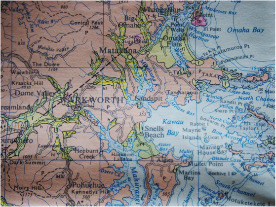
Patches of them occur at many places throughout Northland and some have very different properties from others. A major subject ! These five articles are focused on the ones in the Snells - Algies area, see portion of Geological Map below.
The land was converted from forest to pasture in stages after the Algies family arrived in 1860. Starting by having just a “house cow” and a few chooks it became in due course a dairy farm with some sheep/beef and remained that until the 1920’s when some beachfront baches appeared: subdivision for more of them began in earnest in the 1950’s. Since then there have been several pulses of subdivision and house-building with the addition of “mains” water in the 1970’s and “mains” sewerage in the early 1980’s. Roading was steadily extended and sealed. This sequence has significance for the appearance of slope instability in the early 1980’s and its near-disappearance since.
For many years geotechnical engineers (ie engineers who specialize in designing embankments, cuttings, building foundations, retaining walls etc) have known that Northland Allochthon [formerly called Onerahi Chaos] had a bad reputation re slope instability and building foundations. It is a “big bag” ie includes a wide variety of rocks and soils with very different engineering properties.
Patches of them occur at many places throughout Northland and some have very different properties from others. A major subject ! These five articles are focused on the ones in the Snells - Algies area, see portion of Geological Map below.
1961 Geological map shows small Snells - Algies area as “different” (in green)
Landslip history
A landslip in the early 1980’s about 100m NW of Bethshan dumped sufficient soil on the Beach to form the attractive terrace on top of the sand there. The distorted old Pohutukawas on it still give evidence of that event. Rather than cart the debris away Council placed greywacke boulders around it to shield it from wave action and cemented them in place.
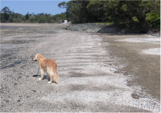
Landslip debris/soils covering part of the Beach below Will James Drive.
Slip debris retained by greywacke boulders - ca 1980.
Slip debris retained by greywacke boulders - ca 1980.
Under pasture the soils on slopes which had found an equilibrium steepness under forest found themselves more exposed to the sun in places with consequent cracking and higher infiltration rates. And transpiration rates were reduced by the change from trees to grass so that more rainwater soaked into the soil. The soil would have distorted downslope slightly in many places and the dilatancy phenomenon many of us are familiar with from “working-up” putty [see under "Soils" above] would have occurred, ie the grains of soil moved around each other and to do so had to move apart a bit. The volume of space (groundwater) around them had to increase and for this to happen water was sucked in. The soil thereby became wetter and weaker.
The baches were (at that time) on roofwater supply and wastewater from septic tanks was distributed via trenches required by Council to be 1m deep. As the soils experienced shrink/swell the “working-up putty” phenomenon continued, focused on the bottoms of the trenches where there was often a supply of moisture (ie sewage) at depth (1m). The soils were worked up, dilated, and became more moist and thereby weaker.
In the late 1970’s “mains” water supply was introduced and it is likely that people responded by using more water, flushing toilets more often, having longer showers and so on. It was at about this time that the major landslip described above occurred dumping a large amount of soil on the Beach not far NW of Bethshan.
Whether the extra water (septic tank effluent) in a 1m deep trench was a key contributor to failure conditions developing cannot be known for sure. Rainwater would certainly have been entering cracks in the soil surface and contributing to the “working-up putty” effect at the bases of the cracks. Where surface cracking extended down to the drainage metal [or high-permeability fill placed in trenches or over field tiles] rainwater would have added to the effluent sent there. The fill in the trenches was probably commonly poorly compacted, allowing surface water to move down quickly by the 1m to the bases of trenches.
The “working-up putty” phenomenon is known as soil dilatancy. An interesting feature of it is that virtually every grain gathers more water next to it: lumps disappear. (Curious?)
This landslip event in the early 1980’s was followed by a “mains” sewer being installed from both ends of the Beach to the pump station in Alexander Reserve. From there the (raw) sewage was (and still is) pumped to the treatment station down Hamatana St in Snells.
A short time after that landslip occurred the beginnings of some house foundations and a concrete driveway in Mera Road cracked and tilted and building work was abandoned. These two events were followed by investigations by Dr Toan and others of Beca Carter Hollings and Ferner(1).
These, together with problems with roading and building foundations on other areas mapped by geologists as Northland Allochthon [formerly Onerahi Chaos Breccia] led to widespread awareness that land so classified could pose problems.
Council commissioned Riley Consultants Ltd of Takapuna to prepare a report on “expansive” soils ie soils with higher than usual shrink/swell. Rileys concluded their report(2) with definitions of “Alternative Solutions” for house foundations and these have been widely followed since 1985. Generally it requires an increase in minimum foundation depth from 450mm to 600mm even in Waitemata and greywacke lithologies. They also recommended that in Northland Allochthon soils such as the 60m year old siltstones “specific design” by a Registered Engineer(3) specializing in geotechnical engineering be carried out. For most houses built in the Bay since 1990 foundations have been in the 60m year old siltstones rather than on the 20m year old weathered Waitemata lithologies or the 120m year old greywackes. They have therefore been taken deeper than 600mm. Piling to 3m or even 4m is not unknown.
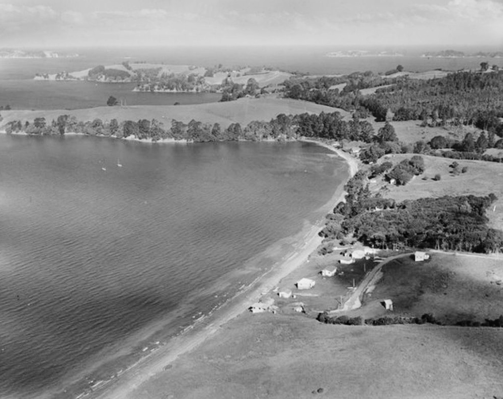
Photo of Snells, Highfield and Algies Bay taken in 1956 showing large grassed areas
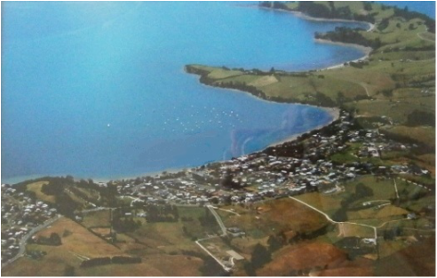
Algies Bay 2014
As more houses were built more of the rainfall which previously fell on the ground was either taken via stormwater drains to the Beach or taken to the treatment plant at Snells. And people planted trees and shrubs around their houses. Compare the photos of ca 1956 and 2014. The replacement of pasture by trees and shrubs is major.
In addition to this the roads were sealed and the increased runoff taken from them direct to the Beach rather than into the soil. The proportion of the ground surface from which rainwater is now taken direct to the Beach (house roofs plus road surfaces) is about 20%. With the trees and shrubs sucking out groundwater the soils have become drier and in some places this has produced noticeable settlement. Such settlement means that the soils become more dense and therefore stronger and landslip conditions less likely to develop.
In the 18 years we have lived in Gordon Craig Place the sealed roadway and concrete footpaths immediately NW of us have been re-laid several times, partly because of shrinkage cracks in the underlying soils. In some places at various times the effects of particular acmena hedges and two large palm trees have been visible as lowered areas between elevated sealed entrance driveways beneath which the soils didn’t have hedge plants extracting water, and weren’t exposed to the sun.
In 2004 geotechnical consultants Tonkin & Taylor Ltd were engaged by Council to report(4) on the state of play. After investigations conducted over several months they reported that,
“Although there are some parts of the Snells Beach and Algies Bay area that are subject to slope instability and land slippage, overall our general observation is that this area, despite its reputation, is only moderate in comparison to other areas that are subject to similar slope instability.”
As described in some detail in the previous articles on Sands, Rocks and Soils, reasons for this improvement must include –
- the “umbrella effect” of house roofs and sealed driveways, paths and roads taking rainfall to the Beach and to the sewage treatment plant West of Snells, and
- the increase in numbers of trees and shrubs on areas which were in pasture (though even earlier in indigenous forest). Some trees and shrubs can continue to extract water from soils long after they have been dried as much as possible by drains.
- the fact that soil strengths increase with soil shrinkage.
Practical matters
1 Section 641a and 36/2 notices on titles of Lots
In the early 1970’s slope instability in the Bay (see above) led Engineers and Council to slap what came to be known as “36/2” notices on Lots. These began as notices applied under Section 641a of the Local Government Act 1974, then became Clause 36/2 notices under the Building Act 1991. The issue is now covered in the Building Act 2004 by an Engineer with professional liability insurance asserting that the land in question is NOT subject to instability. They were originally intended to protect Councils from being sued for issuing Consents for buildings on unstable land. After a few years rumour had it that landslip damage to buildings on the land would not be covered by the Earthquake Commission if they had 641a or 36/2 clauses on their titles. In practice the EQC covered such damage unless an owner had clearly acted contrary to professional geotechnical advice. The topic now comes under the Building Act 2004 which still allows councils to get the Surveyor General to put such notices on titles - usually on the recommendation of a geotechnical engineer.
There is a patchwork of Lots in the Bay which have 641a or 36/2 notices on their titles, mostly applied in the 1980’s. Many Lots have had such notices removed under Section 36/3 of the 1991 Act. In many cases this was done because such notices can cause property sales to fall through. When a lawyer, after searching the title, reports to prospective buyers that such a notice exists they are likely to decide to buy a different house without such a notice on its title.
2 Building foundations
Foundations for houses and other buildings should be taken rather deeper than specified in NZS 3604 – particularly in the soils formed from the 60m yr old siltstones. This was recognized by Rodney District Council who commissioned an investigation which led to their Report No 10085. This includes “alternative solutions” to the foundation depths given in NZS 3604. Formally they become minimum depths to which foundations must be taken in order to “comply with NZ Standards”. For example, for bored piles in the local Greywacke and Waitemata sandstone soils the minimum depth is increased from 450mm to 600mm. It does however leave foundations on the 60m yr old siltstones to be to “specific design”, which means designed by a Chartered Professional Engineer. In some cases in Algies Bay depths of 3m and even 4m have been required by some Engineers. In this 60m yr old siltstone machines drilling such holes for piles find that the unweathered grey siltstone is almost too hard to be drilled and this writer has been happy to say “OK” when that situation has arisen at depths somewhat shallower than prescribed. It means that a depth has been reached to which drying and re-wetting of the original rock has not occurred. It is not unreasonable to assume that if such drying and re-wetting has not occurred in 60m years to date it is unlikely to occur in the next 100 years or a few hundred.
The above suggests that building foundations should be taken below the depth of seasonal shrink/swell in all soils in the area, and for major structures on the 60m year old siltstone right down to the unweathered (grey) parent rock, see “Rocks” article.
This must be done on a Lot by Lot basis, ie there is no one extra depth applicable to all Lots in the Bay. Some recent house foundations for major houses comprise piles more than 4m deep, but generally 1m is sufficient in the Waitematas and 2m in the siltstones.
3 Manage soil shrinkage
Spraying of lawns. This is commonly done throughout NZ where trimming otherwise rank growth immediately adjacent to fences and around posts cannot be done by the type of mower available. The result is a baring of the soil. The soil is exposed to direct rays from the sun rather than being shaded by the leaves of the grass.
This commonly causes the soils to crack thereby initiating what could develop into tunnel-gully erosion. It is particularly likely to do so where the bared soil forms a strip running downslope (see under “Soils” above) but the subsurface water flows may take routes which would not be guessed.
Spraying is just one cause of baring of soils. Any baring is to be avoided.
Topsoils are generally not as susceptible to shrinkage and cracking as subsoils. Cracking visible in topsoils may indicate cracking of the subsoil immediately beneath it.
Covering soils with mulch or bark is recommended as a way to remove this danger. It will also tend to improve the growth of plants by increasing organic matter and by countering the commonly alkaline nature of the soils (see above under “Soils”).
Do not bare the surface of the soils to the sunlight. Avoid spraying with Roundup etc to kill weeds, particularly near fences which run up/down slopes.
4 Manage soil infiltration rates
This applies generally only to grazed areas. Avoid setting up areas where surfaces with high runoff coefficients (low infiltration rates) send surface water onto areas with lower runoff coefficients (high infiltration rates) particularly where there is steep ground nearby.
5 Seawalls
Construct seawalls to reduce the tendency for sand to be taken out, eg – (i) locate seawalls further inland nearer where the sandhills used to be before “homeowners” reclamations were formed, and (ii) slope the walls (like the new one at the Central Reserve) to diffuse wave energy rather than reflect it seawards, and (iii) form a bund to halt longshore drift of sand towards the NW and around to White Bluff.
6 Planting trees and shrubs
This is very wise down sloping fencelines to inhibit the development of tunnel-gully erosion. This has occurred on some properties in the Bay particularly where well-meaning gardeners have sprayed the grass next to them. Soil cracking down the fenceline have led to them joining up at the depth of the base of the cracks and forming tunnels which emerge at the bottom of the slope. In some cases they have emerged as small fountains coming up in the sand on the Beach.
Planting near houses should however be done with care. Cases of noticeable differential settlement of houses have appeared as a result of fast-growing trees, creepers etc sucking water out of the soils under just part of them.
Agriculturalists recognize a value of soil water suction they call “Wilting Point”. It is a suction of 100 kPa which is equivalent to the suction required to suck water up a 10m high pipe. That will have the same consolidation effect on the soil as placing a heap of soil about 5.5m high on it. In a very dry season a tree might suck as hard as that before giving up and dying.
7 Retaining wall design
The high shrink/swell character of the 60m-yr-old siltstones can lead to cracks forming around the posts of timber retaining walls. The cracks on the upsides of posts tend to collect soil crumbs and slopewash and then close up before those on the downslope side. The soils swell when a wetter period of weather arrives and the soil pressures increase on the upslope sides of posts first. This leads to the post leaning slightly downslope. After many cycles of this, with cumulative effects (ratcheting) the posts, and whole walls, can be leaning noticeably downslope. In anticipation of this, posts in these soils should be embedded quite a bit deeper than normal practice and normal analysis suggest.
For example a 1m high wall which might normally be placed in a 1.2m deep hole would, with soil cracking to a depth of 300mm around it be actually a 1.3m high wall embedded only 900mm. It would be bound to lean as the soil became moist and swelled back up!
For this reason there is wisdom in allowing for the probability that the soil will shrink away from the poles of timber retaining walls. Generous increases in pole depth may be a good investment.
The phenomenon of “ratcheting” should be kept in mind in connection with all retaining walls in all soils. It may also be relevant beside large slabs of concrete such as driveways where soil cracking will tend to be concentrated beside the concrete rather than evenly distributed beneath it.
John Hawley 2014
1 Beca, Carter, Hollings & Ferner Ltd, (1980) “report on Onerahi Chaos Breccia for Rodney County Council.”
2 RDC Report 10085.
3 Now known as Chartered Professional Engineers specializing in Geotechnical Engineering.
4 “Snells Beach – Algies Bay Slope Stability Review” Preliminary assessment report. Tonkin & Taylor 2004.
2 RDC Report 10085.
3 Now known as Chartered Professional Engineers specializing in Geotechnical Engineering.
4 “Snells Beach – Algies Bay Slope Stability Review” Preliminary assessment report. Tonkin & Taylor 2004.
